Monitoring Ocean Data: How Can Advanced Maritime Technology Improve Our Waters?
To say that protecting and exploring our oceans is a mammoth job is an understatement.
Covering over 70% of the Earth's surface, these waters help to regulate our climate, sustain life on land and sea, provide us with food, create jobs, transport our goods… the list goes on.
But despite the size and importance of our oceans, humans have done more research into the surface of Mars than the seabed, leaving many mysteries uncovered and challenges unfaced.
Thankfully, over the years, the maritime industry has worked hard to design and deploy cutting-edge technologies that will help us dive deeper into the ambiguities of our waters, gather ocean data and solve some of its biggest threats…
So, what are these technologies — and how are they helping us to protect and monitor our waters?
Protecting ocean ecosystems
To develop creative sustainability solutions that improve the health of marine ecosystems, scientists and researchers need access to large quantities of accurate, real-time ocean data to monitor changing conditions.
Data buoys are deployed in locations all over the world to collect information about the impact of climate change on environmental variables.
Instrumentation onboard data buoys can record and transmit details about surface and sub-surface water temperatures, atmospheric pressure and wave patterns to shore and monitor marine life. Researchers can also observe the impact of plastic pollution on plankton, which plays an essential role in absorbing carbon dioxide and producing oxygen.
Plus, ocean data collection plays a crucial role in facilitating maritime climate action. For example, The Ocean Cleanup's 'System 002' was used to clear 282,787 kilograms of debris from the Great Pacific Garbage Patch. The system collects data from the surrounding environment to inform computational models and predict where circulating currents will cause plastic waste hotspots to form, allowing cleanup teams to identify the best place to begin their extractions. 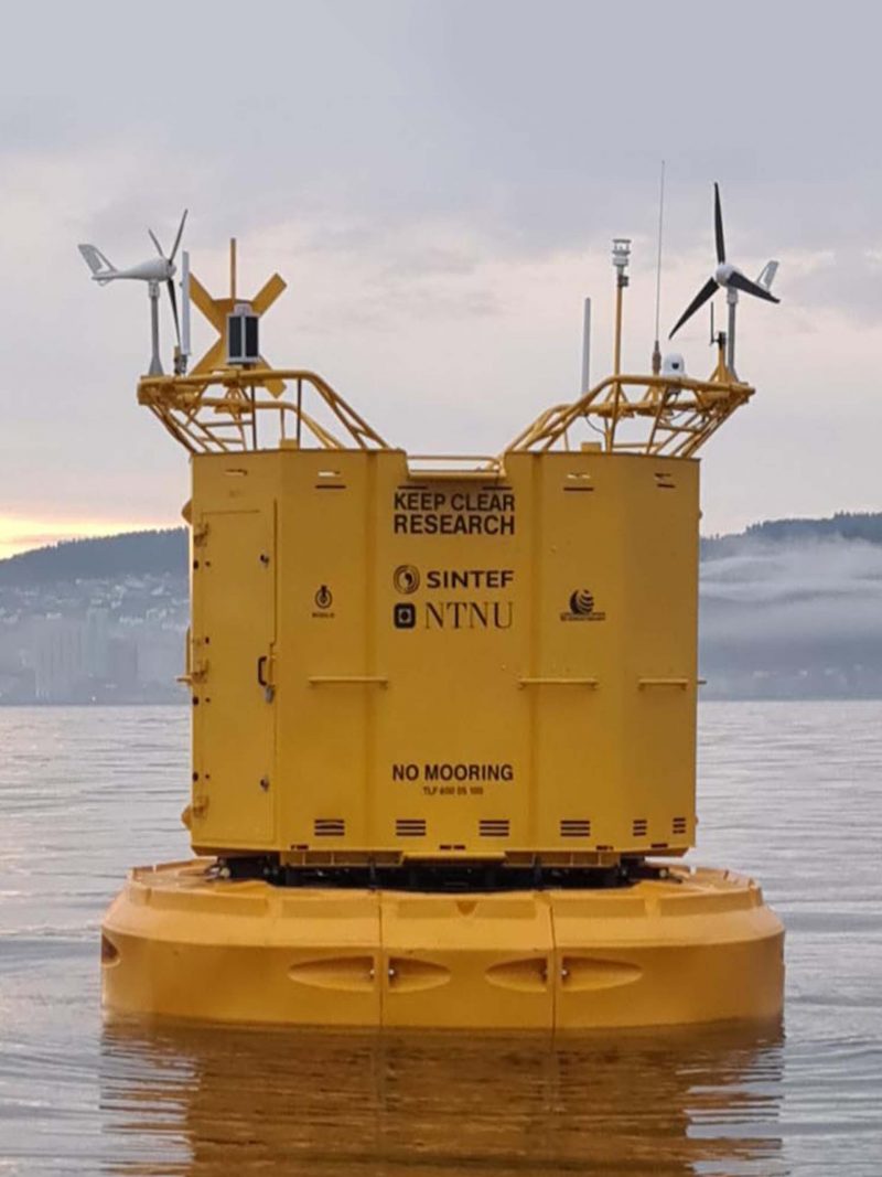
The perfect solution for data collection is the DB 24000 data buoy, which Hydrosphere and Mobilis SA deployed to join SINTEF's floating marine laboratory in Norway in 2021. It features a 'smart' winch that remotely lowers cages full of sensors up to 50 metres deep and takes measurements that contribute to ocean health research.
Hydrosphere also deployed the DB 24000 model for SINTEF's project — which has an impressive array of sensors on board that can perform various functions. Particle imaging, acoustic communications and a 'plug-and-play' interface for custom sensors offer climate researchers endless possibilities, from measuring the plastic or gas content of the water to capturing images as imperceivable to the human eye as phytoplankton.
Preserving marine environments
A lethal combination of warming ocean temperatures, acidification, overfishing, pollution and other factors is causing a decline in the world's precious marine environments — including seagrasses.
Seagrasses provide habitats for an array of marine life — from commercial fish to endangered species — helping to ensure food security, support local economies, maintain the diversity of marine ecosystems, absorb carbon emissions and more.
To restore these depleting marine environments, researchers must identify and mark vulnerable areas, provide boats with an alternative to seabed anchoring and measure the impact of these changes on seagrass meadow health so they can help seagrass recover and regenerate. 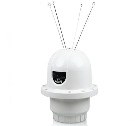
Technologies like the SRT Carbon AIS make this possible. The Carbon offers the ultimate functionality and integration options — including accurate environment monitoring via an optional sensor board that gives researchers a closer insight into the progress of seagrass restoration projects.
Thanks to the Carbon's reliable core technology, it can also be installed onto a moor-less data buoy and left for years without maintenance — minimising the impact of human activity to protect the seagrass we have and help restore what we have already lost.
Gaining visibility of marine assets
As offshore projects move into deeper waters and harsher environments, the need to remotely operate marine assets and improve the safety of workers increases.
What allows vessel operators to determine safe routes and monitor vessel performance? When can project managers decide if weather conditions are ideal for marine workers? How can researchers accurately monitor ecosystems in hard-to-reach locations?
Whilst the answers to these questions may seem subjective, real-time ocean data and marine asset monitoring make them objective.
Our HydroWatch, for instance, provides real-time data from instrumentation and aids to navigation (AtoN) assets. From water temperatures and atmospheric pressure to sea state observations like currents, real-time data monitoring enables mariners to analyse trends and monitor anomalies at sea — allowing for more informed decision-making on vessel dispatch and route optimisation, reducing safety risks for maintenance crews and improving planning and efficiency for offshore site workers. 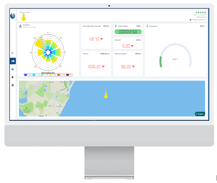
HydroData serves as a cloud-based monitoring portal for the HydroWatch unit. It offers a centralised platform to easily track and manage marine assets that may be dispersed across multiple locations or set in remote environments.
With the increasing development of these advanced ocean monitoring and data-transmitting technologies, more hope lies ahead for the health of our waters.
At Hydrosphere, we understand the importance — unique challenges — of operating advanced technology in marine environments. Get in touch for expert advice and to discuss our AIS and monitoring solutions today!